Best easy hikes on the Garden Route: scenic walks for all levels
Two (mostly) easy-going hikes on the Garden Route
On our road trip along the Garden Route, we didn’t want to see all the sights just through the windows of our car. So we decided that we were going to add a bit of walking to our trip. We made multiple stops along the way, but enjoyed Robberg Nature Reserve and Tsitsikamma National Park the most. Possibly because these were the only ones we could do without getting soaked with all the downpours, but they were great all the same.
Each offered well-marked trails, good scenery, and an enjoyable way to spend a few hours. And all of that without turning the day into an endurance event. Although I should definitely have worn better shoes to the Robberg Nature Reserve.
The first hike: Robberg Nature Reserve
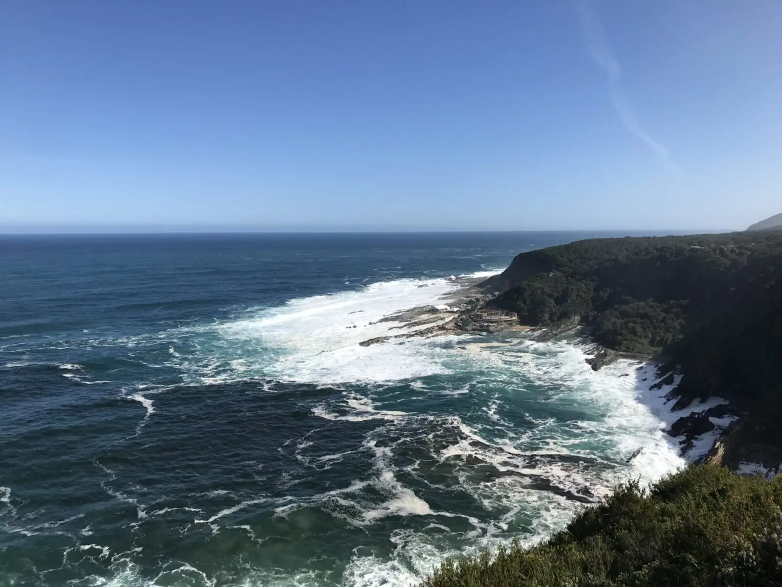
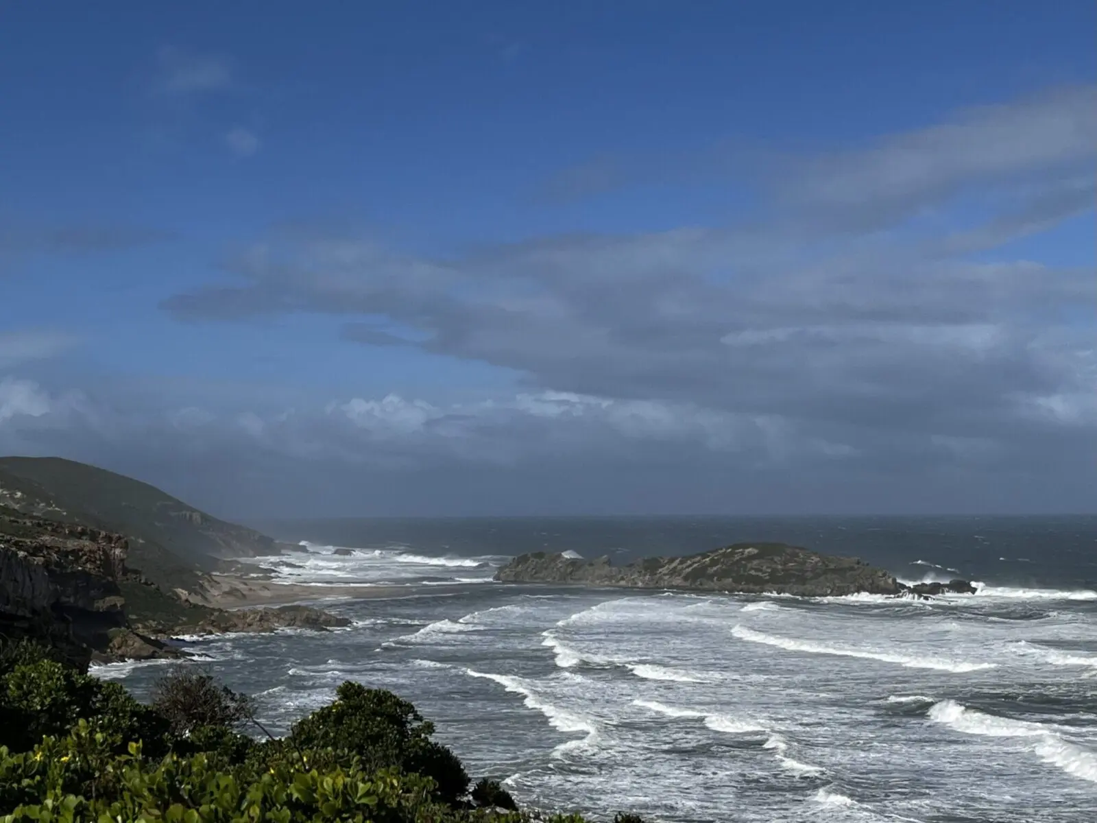
Between the rain showers on our drive from Oudtshoorn toward Tsitsikamma, we had just enough time to fit in our first hike at Robberg Nature Reserve, near Plettenberg Bay. We’d only spent five minutes in Knysna and in Wilderness before sprinting back to the car to avoid getting soaked. When we arrived at the entrance to Robberg Nature Reserve the weather looked slightly more promising. This time, we were going to see more than just the parking lot and a brief look at the Knysna Heads! After a quick glance at the dark clouds gathering in the west we parked the car and walked over to the start of the trails.
Three trails
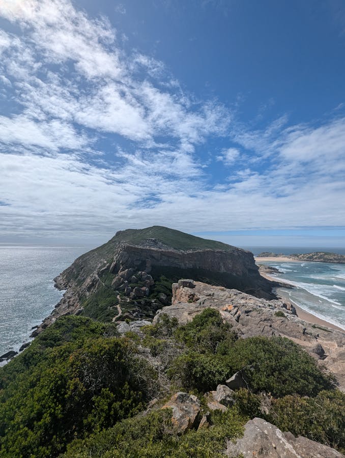
There are three trails to hike in the Robberg Nature Reserve. They all start from the parking lot and they’re all circular. Good, as this means you won’t have to walk the same way back.
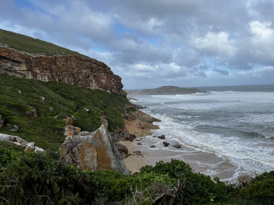
The first one is the Gap Circuit – this is the one we did. It’s about 2 km and it takes roughly half an hour. More if there’s just been a downpour and one of you is not wearing proper footwear. But I’ll get to that. It’s not a difficult hike and it has great coastal views. You can go down to the beach if you want. We did this and it adds some extra time.
The second hike is the Witsand Circuit – It’s around 5.5 km and it takes two hours or so. A bit of climbing along the northern ridge, views of the seal colony, then down past the dune and boardwalk. We had seen the storm clouds and decided to give this one a miss, although it looked doable.
Finally there is the Point Circuit. This one is about 9 km and should take 3–4 hours. I think these are twenty-something backpacker hours but I can’t be sure. It reaches the tip of the peninsula. It’s a mix of terrain and has good ocean views. It’s said to be the hardest of the three, especially if you tackle the rocks near the water.
So – how hard was the walk?
I may have already given it away: sandals and a recent downpour are not a good combination when walking these trails. The paths were slippery, and so were the rocks we had to climb over at certain points. At the steepest climb there was a rope I could use to pull myself up. I’m proud to say I made it all the way without needing assistance. The rest of the family, better equipped, had no issues at all.
The walk itself wasn’t too difficult. There were enough ups and downs to make it clear this wasn’t just a warm-up stroll. The paths were uneven, with a bit of scrambling over rocks. Nothing scary or extremely strenuous though.
It is not wheelchair-accessible, nor is it suitable for people with reduced mobility. That said, everyone who is in reasonably good shape can do this – even if your backpacking days (if you had them) are behind you. I’ve noticed that these days the biggest hurdle is often not fitness itself, but the quiet little doubts beforehand: will I fit, will I cope?
The second hike: to the suspension bridges of Tsitsikamma National Park
The second hike we did was part of the famous Otter Trail. The Otter Trail is a 5-day coastal hike that takes hiking enthusiasts across beaches, cliffs, and forests. It’s challenging, with steep climbs, wading through rivers and long days, so it’s suitable for experienced hikers or anyone ready for a serious adventure. This, as you may have realised by now, is not us.
Three trails
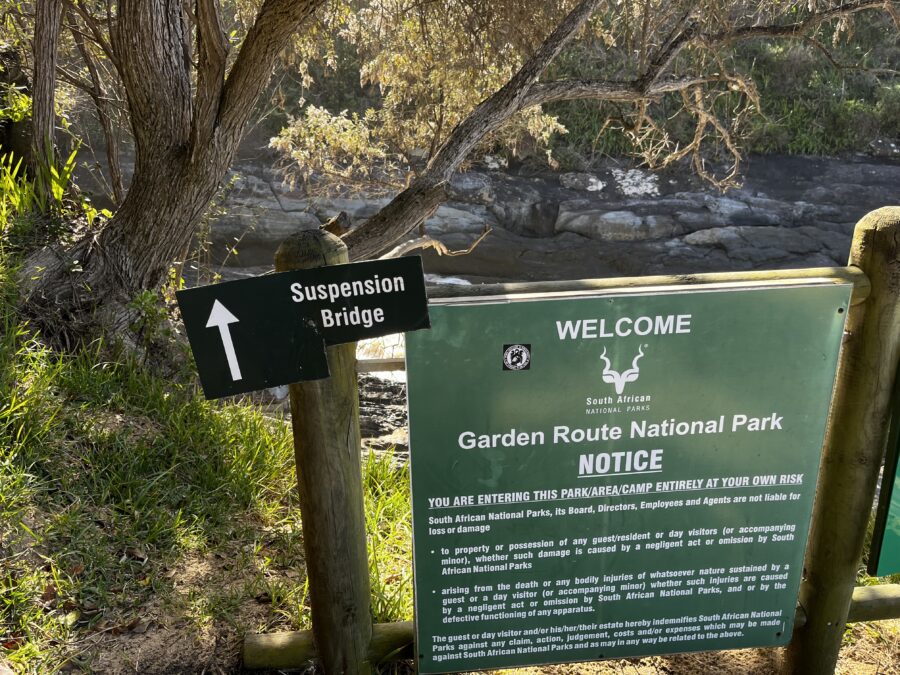
So when I said we did part of the Otter Trail, of course I meant the easy part. We did one of the three hikes that start from the parking lot Kareedouw Car Park. This is inside the Tsitsikamma section of the Garden Route National Park. Because it’s part of the national park, you need to pay an entrance fee and complete registration and indemnity forms. If you have a wild card you can use that here and skip the fee, but you’ll still need to fill out the forms.
There are three trails leaving from here, varying in length and difficulty.
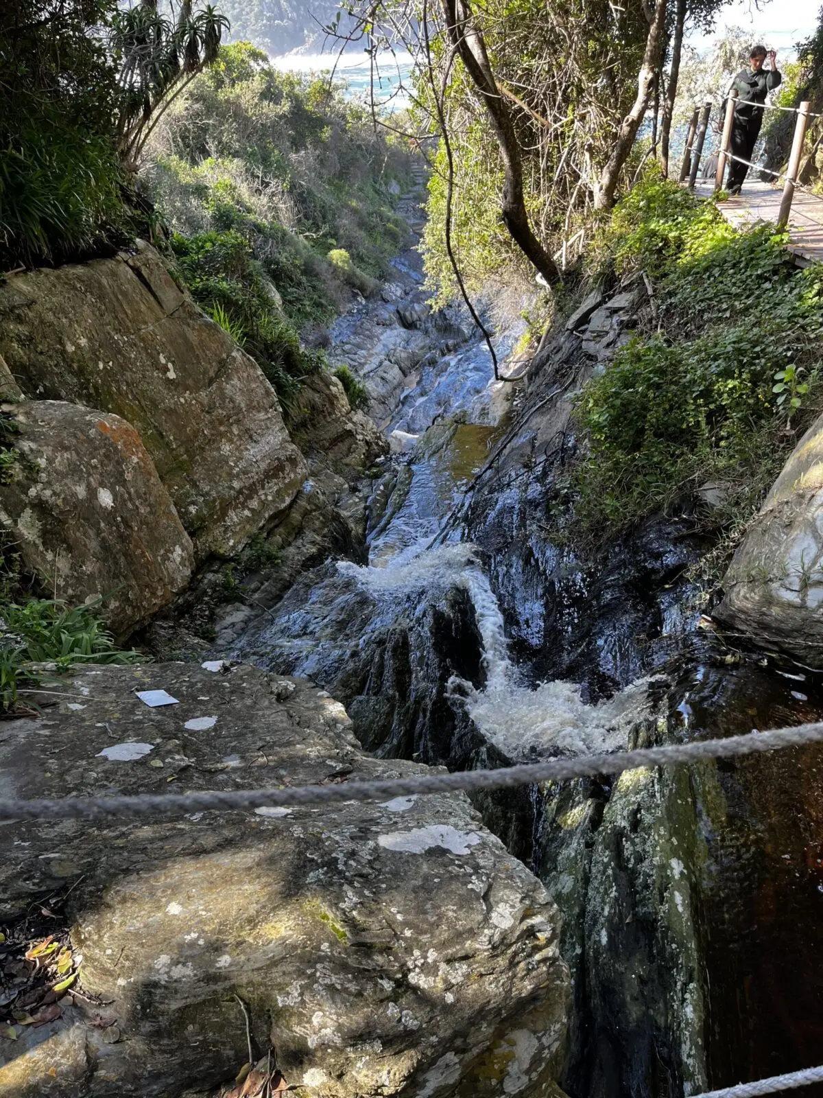
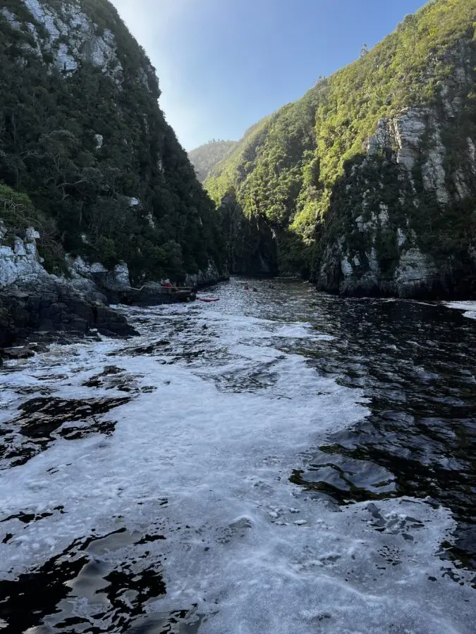
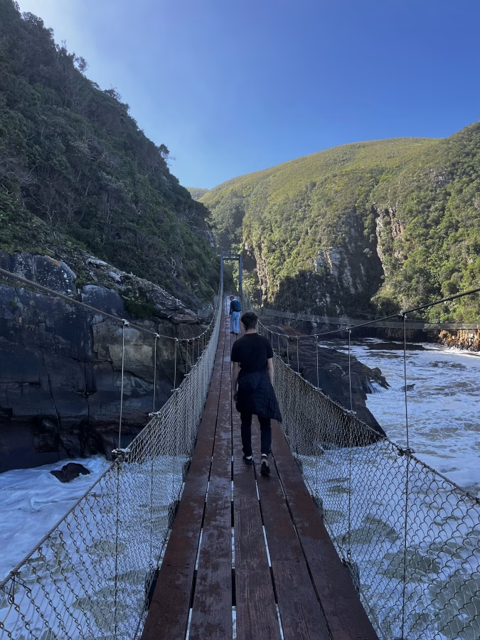
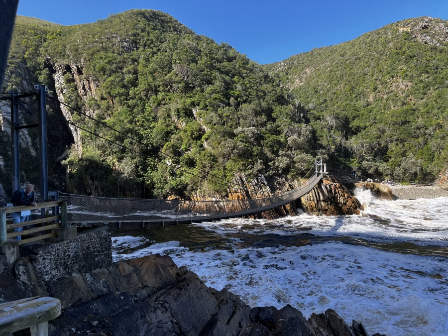
The first one is the Stormsriver Mouth Hike. People generally call it the Tsitsikamma Suspension Bridge Hike, because that’s exactly what it is. It’s 2 kilometers and relatively easy, although it does take you up and down quite a few steps. The path is a boardwalk, but because of all the steps, it is not wheelchair-friendly and I wouldn’t recommend it if you have bad knees. The walk takes you across three suspension bridges (7 meters over the river mouth on a good day – much less when we did it. Spoiler). After the bridges you can hike up to a view point with great views over the ocean.
The second one is the Blue Duiker trail. A Blue Duiker is a sort of antelope, and although you don’t need to be an antelope to hike the trail, this one isn’t as easy as the one to the bridges. It’s like the Suspension Bridge walk’s more adventurous cousin: longer (about ~3.7 km), quieter, and wandering through proper forest rather than just boardwalks. You will need to be reasonably sure-footed. There are roots, uneven ground and a stream crossing here and there. This means it’s less “easy stroll” and more “keep your balance (and dignity)”. It gives you scattered viewpoints and a small waterfall, but it doesn’t take you to the suspension bridges, so if you want to see those and only want to do one hike, this isn’t the one.
The third one is the Waterfall Trail. This is a slightly more challenging alternative to the Suspension Bridge walk and the Blue Duiker Trail: about 6 km return, quieter, and following rocky coastal paths rather than forested boardwalks. You’ll need to be sure-footed, as the trail includes uneven ground, loose stones, and some light scrambling. Guidebooks say it takes 3-4 hours, but I’d take that with a grain of salt. If you do decide to go on this walk, you’ll get to enjoy ocean views, coastline photo opportunities and of course, a waterfall flowing directly into the sea. Where it doesn’t take you? To the suspension bridges.
So – how hard was the walk?
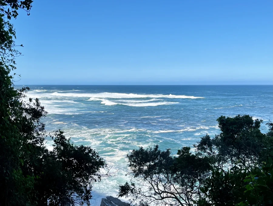
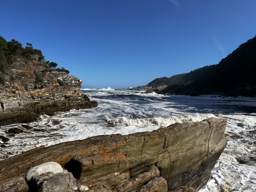
It may not surprise you that we opted for the Storms River Mouth trail. After all, we were here for the bridges. The rest was a bonus. After some staring at the gigantic waves crashing right next to the parking lot, we started the walk. The start wasn’t clearly signposted but eventually we found the staircase leading to the head of the trail behind a building.
After crossing a tropical-looking white sandy beach, we got to the first boardwalk. The first part was really easy going: boardwalks with railings and occasionally some steps; mostly up, never more than twenty steps at a time. There were signs about the flora and fauna along the trail, and even an open-air classroom.
Once we got closer to the suspension bridges, there were more steps. Going down, they were quite heavy on the knees so this is something to take into consideration. I don’t have bad knees, but I still felt them after all the steps down.
The suspension bridges felt properly adventurous — the tide was coming in, a storm had just passed, and waves were smashing just below the bridges, sometimes even splashing over. Not while we were on them, thankfully… though I did sprint once when a particularly monstrous wave came barreling my way.
Once we’d crossed the bridges, we scrambled down to a small pebbled beach but didn’t linger because of the incoming tide. We hiked up to the viewpoint (ocean views, beautiful but not really worth the extra effort in my opition). Back at the bridges we sat on the rocks for a while, keeping an eye on the waves — not keen on being washed off and ending up in Patagonia.
We lingered on the rocks a bit too long, then tackled the uphill scramble over all those steps — the thigh muscles aching now, not the knees. By the time we got there, that beautiful white sandy beach from the start of the story was almost gone. The tide had claimed it, and we had to sprint across what little sand there was, timing it perfectly before the next wave came crashing in. Somehow, we made it back to the car mostly dry and unscathed. We had considered doing the Blue Duiker Trail afterward, but wisely decided against it and instead went to watch people bungee jumping off the Bloukrans Bridge — equally thrilling, but with far less effort on our part.
Some brief answers to frequently asked questions
After exploring both Robberg Nature Reserve and Tsitsikamma National Park, we were pleasantly tired and full of memories. For anyone planning a visit, especially those who prefer a steadier pace or want to make the most of the scenery without overexerting themselves, we’ve put together a FAQ with practical tips and insights from our hikes.
None of the trails are wheelchair-accessible, nor are they suitable for people with reduced mobility. However, if you can navigate steps, uneven paths and the odd quick scramble over rocks, the shorter trails in both Tsitsikamma National Park and Robberg Nature Reserve are doable. Provided you’re not trying it in flip flops or sandals. Especially after rain, paths can get slippery.
A little planning goes a long way. Sturdy shoes are essential, even for the easier walks. Bring water, snacks, and sun protection. If you’re heading to the coast or tidal beaches, check tide times. A small backpack keeps your hands free for balance, especially on scrambles or rocky sections.
If you have a Wild Card, you can use it for both Robberg and Tsitsikamma. If you don’t, you will have to pay an entrance fee. Check current rates online. Extra activities, like going kayaking or liloing on the river or bungeejumping, have separate fees.
Take breaks. Really. The views are worth it. If full loops feel too ambitious, try sections instead. Bring a camera — you won’t regret it. There are plenty of spots to stop and enjoy a snack or even a picnic.
Both parks are stunning, with trails for different energy levels. With a bit of planning and awareness of the terrain, almost anyone can enjoy their beauty, take memorable photos, and come home with stories worth sharing.
These hikes were part of our three-week trip through South Africa. You can have a look at the itinerary for the what, why and how.